Railway
Home NEW Updates About the Group Heritage Sites Committee Contact Us Terms/Conditions
|
STATIONS AND SIDINGS Research by Gordon Freegard Listed below are the details of all the Railway Stations and Sidings known to have existed on the Upper Darling Railway between Midland Junction and the terminus at Karragullen. We have now slotted in copies of the appropriate old maps from the Third Edition of The Metropolitan Area and Environs Road Maps and Index dated June, 1947.
|
|
MAP FROM 3RD EDITION METROPOLITAN STREET DIRECTORY 1947 #47
|
|
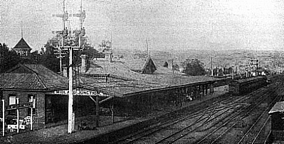
Midland Junction (10m 28ch) |
|
EARLY PHOTO OF MIDLAND JUNCTION STATION #34
|
|
Bushmead (11m 30ch) |
|
|
|
Hesketh's Siding
|
|
Rifle Range
|
|
MAP FROM 3RD EDITION METROPOLITAN STREET DIRECTORY 1947 #48
|
|
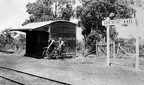
Ridge Hill (14m 58ch) |
|
RIDGE HILL SHELTER THE DAY BEFORE THE RAILWAY WAS CLOSED #35
|
|
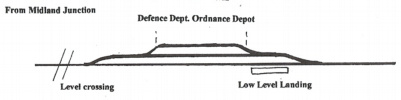
City Council's Siding (14m 62ch)
|
|
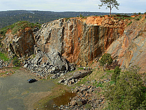
Statham�s Quarry (15m 62ch) |
|
A RECENT PHOTO OF THE ABANDONED STATHAM'S QUARRY #41
|
|
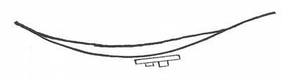
The Zig Zag |
|
ZIG ZAG SECTION OF RAILWAY #39
|
|
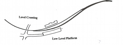
Gooseberry Hill (18m 77ch) A siding appears to have been provided at this location in the days of private operation, but a low level platform and shelter shed were the only facilities provided since Government operation of the line. |
|
|
|
MAP FROM 3RD EDITION METROPOLITAN STREET DIRECTORY 1947 #49
|
|
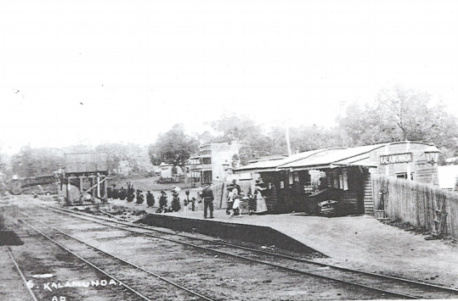
Kalamunda (20m 10ch) |
|
|
|
KALAMUNDA RAILWAY STATION IN THE EARLY 1920'S
|
|
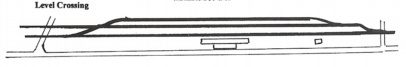
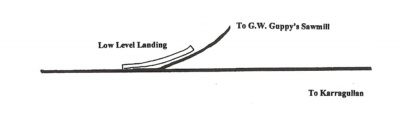
South Kalamunda (21m 7ch) |
|
|
|
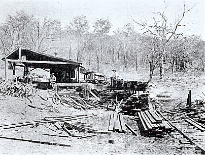
GUPPY'S MILL SERVICED BY SOUTH KALAMUNA SIDING. #36
|
|
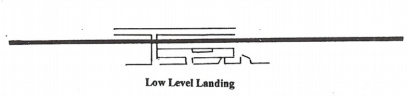
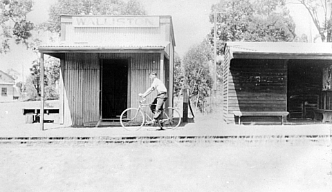
Walliston (22m 42ch) |
|
|
|
WALISTON LANDING THE DAY BEFORE THE RAILWAY CLOSED. #37
|
|
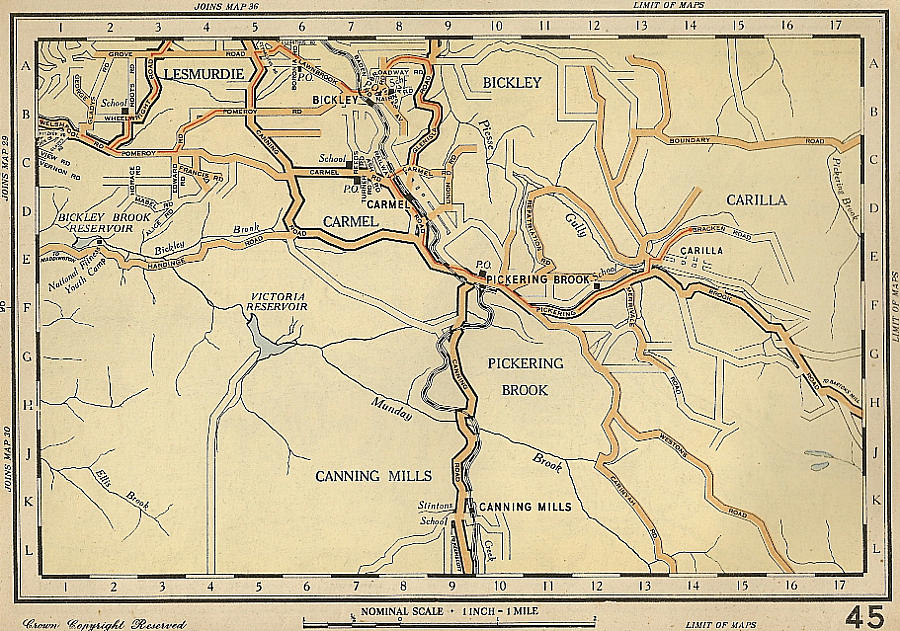
MAP FROM 3RD EDITION METROPOLITAN STREET DIRECTORY 1947 #50
|
|
Bickley (23m 45ch) |
|
|
|
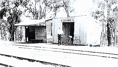
Carmel Siding (24m 48ch) |
|
|
|
CARMEL SIDING THE DAY BEFORE THE RAILWAY WAS CLOSED #30
|
|
Turner's Siding (25m 11ch) |
|
|
|
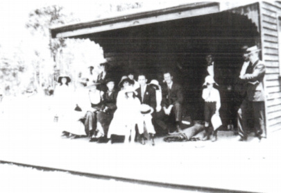
PASSENGERS WAITING AT TURNER'S SIDING c1920 #13
|
|
Monument Hill (25m 68ch) |
|
Pickering Brook (26m 9ch) |
|
|
|
PICKERING BROOK STATION THE DAY BEFORE THE RAILWAY WAS CLOSED #31
|
|
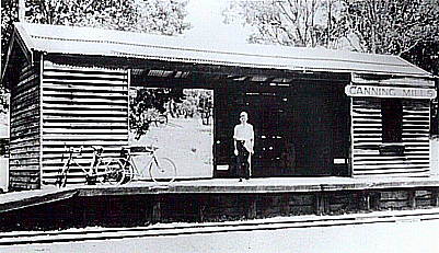
Canning Mills (29m 57ch) |
|
|
|
CANNING MILLS STATION THE DAY BEFORE THE RAILWAY CLOSED #32
|
|
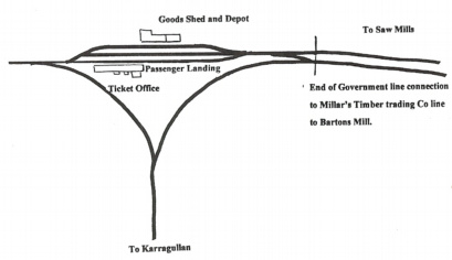
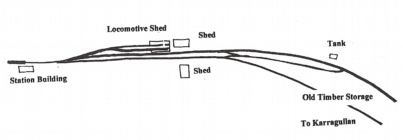
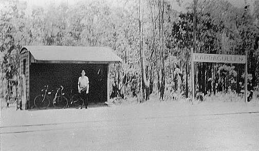
Karragullen (31m 2ch) |
|
|
|
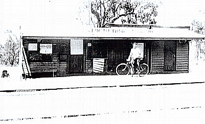
KARRAGULLEN TERMINUS THE DAY BEFORE THE RAILWAY CLOSED #38
|
|
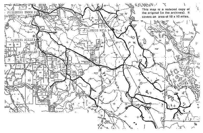
MILL FORMATIONS (OR TRAMWAYS) IN THE FOREST 1891-c1940 THIS IS A REPRODUCTION MAP MADE BY MR. J. AUSTIN OF THE A.R.H.S. IN 1982. IT INVOLVED TRACING ALL REMNANTS OF THE TRACKS ON FOOT. THE FORMATIONS WOULD NOT ALL HAVE BEEN IN POSITION AT THE SAME TIME
|
|
References: Article: Kalamunda of the Dreamtime- F.J.McNamara
Copyright : Pickering Brook Heritage Group Inc. 2008-2019
|